
Radar Technology Reveals Military base Under Ice
Radar Technology Reveals Military base Under Ice
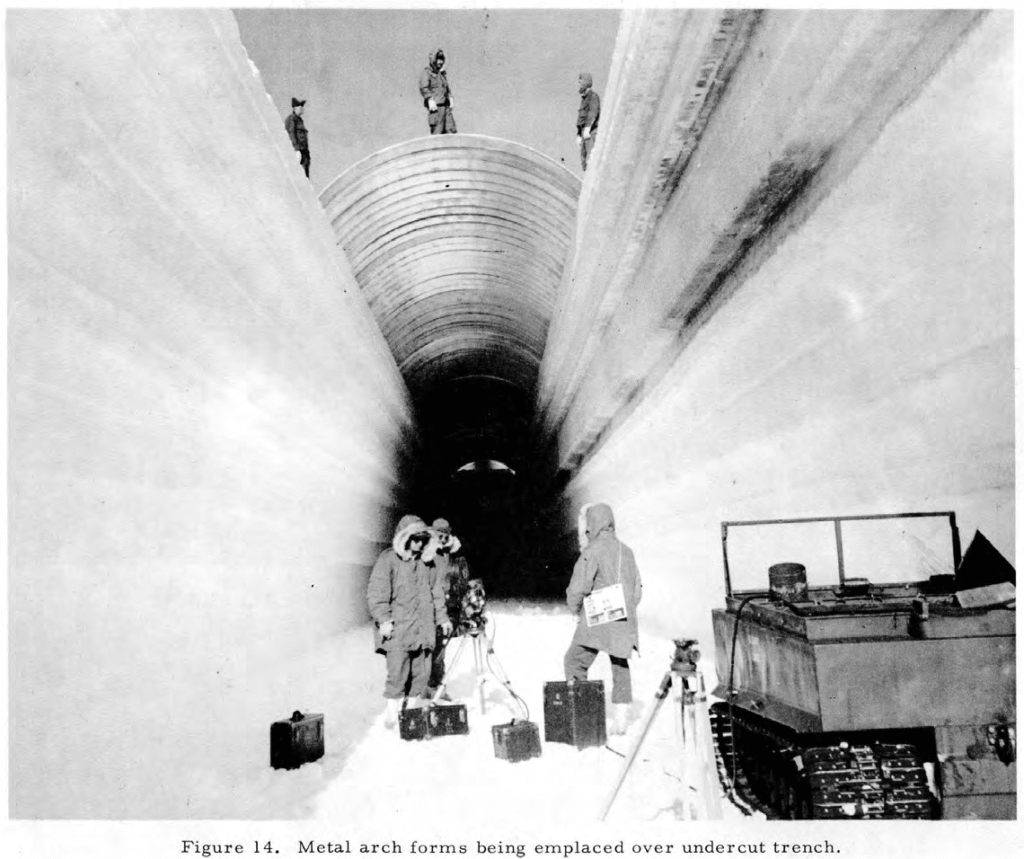
A NASA study aimed at mapping the internal structure of the Greenland ice sheet made an exciting discovery: Camp Century, a secret Cold War-era U.S. military base, entombed 100 feet beneath the surface. This monumental find demonstrates the unparalleled power of advanced remote sensing for subsurface mapping and digital reconstruction.
Using Uninhabited Aerial Vehicle Synthetic Aperture Radar (UAVSAR) scientists precisely located the 9,800 feet of buried tunnels. This successful data acquisition provides a critical 3D model of a complex, hidden structure, turning a rumor into reality.
The precision data also reveals an urgent environmental challenge: the base contains nuclear waste projected to be exposed by melting ice around 2090. This incredible discovery underscores how 3D geospatial data is now essential for both unexpected archeology and proactive climate change monitoring.
Read More: https://www.bgr.com/2003369/nasa-found-secret-us-military-base-buried-greenland-ice-shelf
Written by Adam Clark. Adam has spent the past 13 years exploring the world from above by using drones, satellites, and mapping tools to better understand our landscapes. Connect with him on LinkedIn: Adam Clark
Note: We are aware of others saying that this base has been known about and documented for a long time so we can take the ‘discovery’ claim with a grain of salt.
More Recent News: Seeing with Machines: Lidar as Cultural Art