
The Story of Emesent and Co-Founder, Dr. Stefan Hrabar
Introducing Emesent and Dr. Hrabar
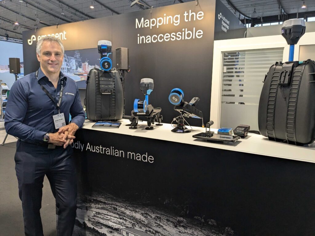
Many of our readers are familiar with Emesent, a global leader in mapping challenging environments and the developer of the Emesent Hovermap lidar system. Lidar News recently had the opportunity to interview co-founder Dr. Stefan Hrabar to explore the origins of Emesent, their latest advancements, and their vision for the future. At Lidar News, we’ve always valued the people behind the scan, and we hope you enjoy the story behind Emesent. A big thank you to Stefan for an engaging and insightful conversation.
A Primer on Emesent
Emesent has redefined the way industries map and explore challenging environments with their flagship product, Hovermap, an advanced lidar-based autonomy and mapping solution. Designed for use on drones, vehicles, and handheld applications, Hovermap stands out for its ability to operate in GPS-denied environments using cutting-edge Simultaneous Localization and Mapping (SLAM) technology. Unlike traditional lidar systems, Hovermap seamlessly integrates autonomy, obstacle avoidance, and real-time data processing, making it an indispensable tool for industries such as mining, architecture, engineering, construction (AEC), oil and gas, forestry, and infrastructure inspection.
With its beyond-line-of-sight autonomy, Hovermap allows drones to explore and map environments without GPS, making it ideal for underground mining and complex industrial inspections. The system has been widely adopted at over 200 mines and by hundreds of customers in other markets, demonstrating its transformative impact on safety, operational efficiency, and data accuracy.
The Journey of Stefan Hrabar
Stefan Hrabar’s journey into robotics and lidar innovation began in South Africa, where he completed his undergraduate and M.Sc. degrees in Mechanical Engineering. His passion for robotics led him to the United States in 2001, where he pursued a Ph.D. in Computer Science at the University of Southern California (USC). His research at USC focused on vision-based drone navigation, leveraging stereo vision and optic flow for autonomous perception.
Moving to Australia and the Birth of Hovermap
In 2006, Hrabar relocated to Australia to join the Robotics Group at CSIRO, where he continued his work on drone autonomy. Around 2014, he began integrating lidar technology into drones, setting the stage for groundbreaking advancements in autonomous mapping. As a Senior Research Scientist, Hrabar led a team of approximately ten researchers, ultimately spearheading the development of the first Hovermap prototype.
Recognizing Hovermap’s commercial potential, Hrabar and his colleague Farid Kendoul entered the CSIRO accelerator program (the ON Program) in 2016. Through this initiative, they refined Hovermap’s applications and launched an Early Adopter Program, attracting 18 paying customers and generating nearly AUD 1 million in revenue with a 3D-printed prototype.
Launching Emesent and Hovermap Lidar
Founding
Hrabar co-founded Emesent in October 2018 alongside Farid Kendoul, assuming the role of CEO while Kendoul became CTO. The company secured seed funding led by Main Sequence Ventures and quickly made an impact in the geospatial industry. In late 2023, Hrabar transitioned to Chief Strategy Officer in order to focus on his passion of driving product innovation, while bringing on Charles Miller as CEO.
Emesent introduced the first version of Hovermap at Geo Week 2019, featuring lidar-based SLAM, collision avoidance, and GPS-denied velocity control. It was the world’s first SLAM-based lidar autonomy payload that could be used both on and off drones. The innovation continued with the launch of beyond-line-of-sight autonomy in 2020, allowing drones to explore complex and GPS-denied environments autonomously.
Recent Advancements
Since its initial launch, Emesent has expanded its ecosystem with a range of accessories and capabilities designed to enhance LiDAR mapping and autonomy. These advancements include colorization for enriched point cloud visualization, an improved GCP (Ground Control Point) workflow for enhanced georeferencing accuracy, and versatile mounting options such as vehicle and backpack configurations for flexible data capture. Emesent has also integrated Hovermap with leading robotics and UAV platforms, including DJI’s M300 and M350 drones, Freefly Astro, and Boston Dynamics’ Spot robot, enabling seamless deployment across diverse environments.


Complementing these hardware upgrades, Emesent has introduced Aura software for advanced point cloud processing and analysis, along with the Commander app, which simplifies mission planning and autonomous operation control. These innovations collectively strengthen Emesent’s position as a leader in autonomous LiDAR mapping solutions.
Advancements in RTK and Camera Integration
In 2024, Emesent introduced RTK capabilities and integrated cameras, enhancing the precision and visual context of its LiDAR data. The addition of 360° and panoramic imaging, along with colorization, allows users to capture rich, georeferenced visuals alongside LiDAR scans. This enables seamless viewing and analysis in platforms like Cintoo, Pointerra, Prevu3D, and Emesent’s Aura software, providing a more immersive and detailed representation of scanned environments. RTK (Real-Time Kinematic) integration was also introduced, allowing precise georeferencing of point clouds for vehicle and backpack-mounted applications. The new RTK system supports receivers from Emlid, Trimble, and Leica, significantly improving SLAM results.
Transforming Mining and Beyond
Hovermap’s first major market was underground hard rock mining, where it became the first autonomous drone-based stope mapping solution. The technology has since expanded into various mining applications, now being used with over 130 mining companies worldwide.
Beyond mining, Hovermap has proven invaluable in industries such as:
- AEC (Architecture, Engineering, and Construction)
- Oil & Gas
- Forestry & Environmental Monitoring
- Infrastructure Inspection

Emesent Today and the Road Ahead
Emesent has grown into a global leader in autonomous digitalization, particularly for GPS-denied environments. With a team of 120 professionals based in Brisbane, alongside offices in Denver and the UK/Europe, the company continues to expand its reach. Supported by 50 resellers worldwide, Emesent remains dedicated to advancing autonomy and mapping technology.
Looking ahead, Emesent’s roadmap includes:
- Autonomous Exploration Enhancements
- Continued SLAM Algorithm Improvements
- Deeper Integrations with 3rd Party Software
- Expansion to Additional Drone Platforms
- Streamlined End-to-End Workflows in Aura
Emesent’s journey from a research project to a leader in autonomous lidar mapping is an inspiring story of entrepreneurship and innovation. Their work has pushed the boundaries of SLAM technology and transformed how industries map and navigate challenging environments. A big thank you to Dr. Stefan Hrabar for sharing his time and insights with us—it was a pleasure learning about Emesent’s past, present, and what’s next.
For more information about Emesent, please visit their website – https://emesent.com/
Pingback: How LiDAR and Photogrammetry Are Redefining AEC Workflows – Between the Lines Blog